HIGH
GREEN FIELD KNOTT & HORSE HEAD MOOR from
YOCKENTHWAITE, LANGSTROTHDALE
Summary
Date - 21st October 2007
Distance - 13.5 miles
Map - OL2/OL30
Start point -
Road side parking
Yockenthwaite (SD 905789)
Summits Achieved
Name
Height (ft)
Height (m)
Grid Ref
High Green Field Knott
1976
602
SD 8454 7843
Horse Head
Moor
1999
609
SD 8872 7798
The Walk
It has been weeks and weeks since
we had walked with Uncle Bob, so we were very happy when Dad told
us we would be off on Sunday to the Yorkshire Dales to meet him
and climb two more hills.
We had to be up and ready early as
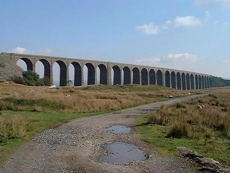
we set off about 07.30. The drive took us to Ingleton, famous for
its waterfalls, and then over to Ribblehead where there is a huge
viaduct that carries the Settle to Carlisle railway over the
valley. This is an archive photograph taken some years before.
Driving on we next came to the town
of Hawes then on through the village of Gayle and over the tops
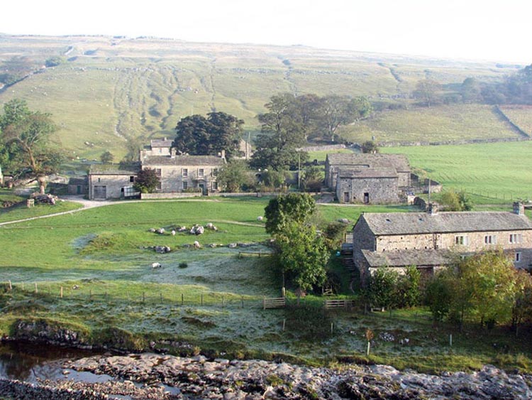
eventually to the hamlet of Yockenthwaite where we met up with
Uncle Bob and started the walk. You can see that it had been a
cold night as there is still frost on the ground.
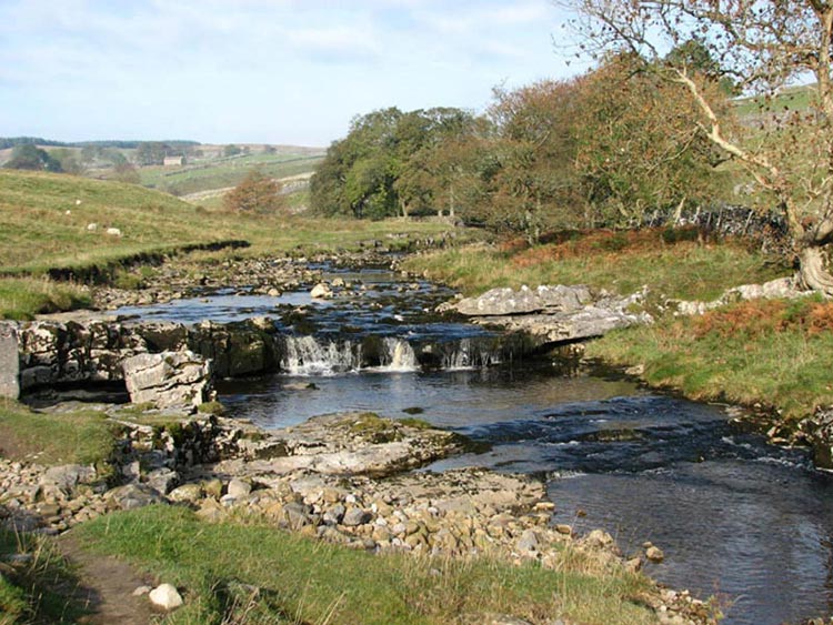
After crossing Yockenthwaite
Bridge, we headed towards the buildings but soon took a track on
the left through a gate and then onward beside the River Wharfe
that flows on its way over many cascades.
It was absolutely delightful and
there were many ideal places to sit and picnic, but it was still
early and Dad too said we had a long way to go. We came to a
house called Beckermonds where we continued up the valley but now
on a narrow and gated road.
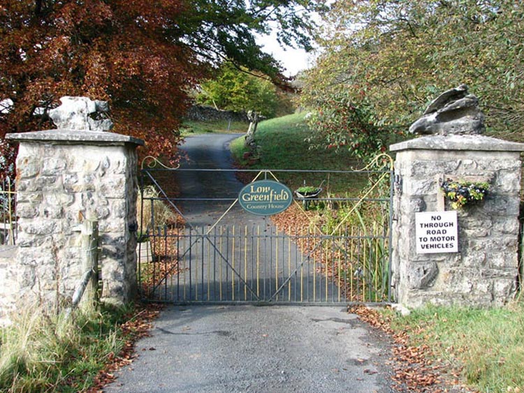
After what seemed a long time we
came to a place called Low Greenfield, that had an entrance of
imposing pillars and gate across the road. We thought we might
not be allowed to go through but as you can see only vehicles are
not allowed.
We still had not started to climb
and we began to wonder if we were ever going to bag any summits,
but Dad told us that soon it would be steeply uphill. That was if
only Uncle Bob and he could find a way through the dense forest
that clad the lower half of the fell.
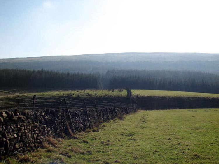
If you look carefully
at this photo you can see in the centre what appeared to be a
clearing in the forest and it seemed to go all the way to the
open fell. This was not the route that Uncle Bob had originally
envisaged but Dad seemed to think that it was a good option.
Uncle Bob agreed to try it and off we went. It was necessary to
climb a fence to gain access, so this was not what could be
called an authorised route. There seemed to be a path and we kept
close to a wall on our right. The ground underfoot was very wet
and it was completely and eerily silent as we climbed on up
reaching a bank that brought us to a forest road. This was on the
map so we knew that we were halfway. The path/clearing continued
on the other side but much more steeply. After negotiating an
area of dead nettles (they still stung though!) we reached
another fence once over which, we were on the open fell. This had
been the most worrying part of the route to find so we were all
relieved it was over. Then we continued steadily up to the ridge
and finally to the top of High Green Field Knott just beyond a
wall corner.
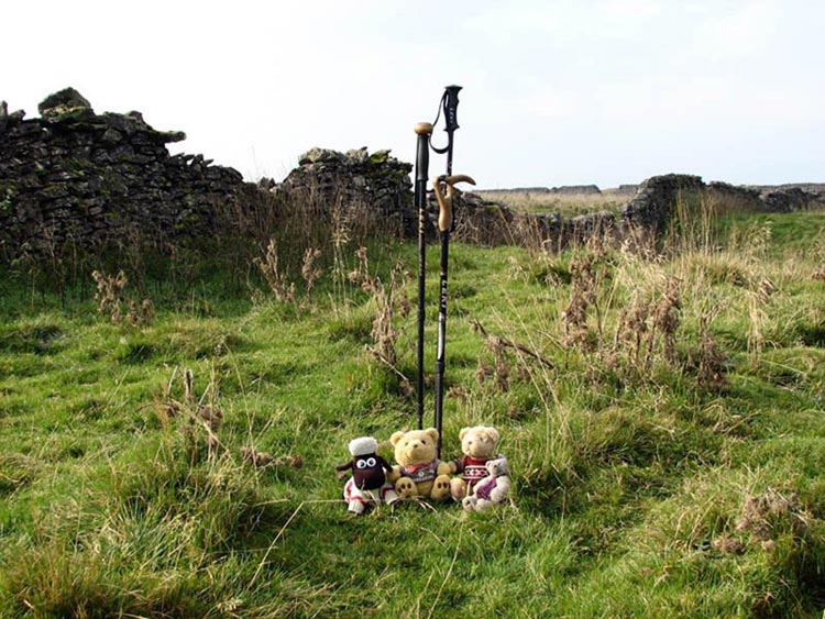
Unlike the Lakeland Fells the
summits in the Yorkshire Dales are often large flat areas. It was
therefore necessary for Uncle Bob to use his GPS to find the
exact top as per the Ordnance Survey, and once done his and Dad's
stick was planted to mark the spot and we hopped out to have our
photo taken.
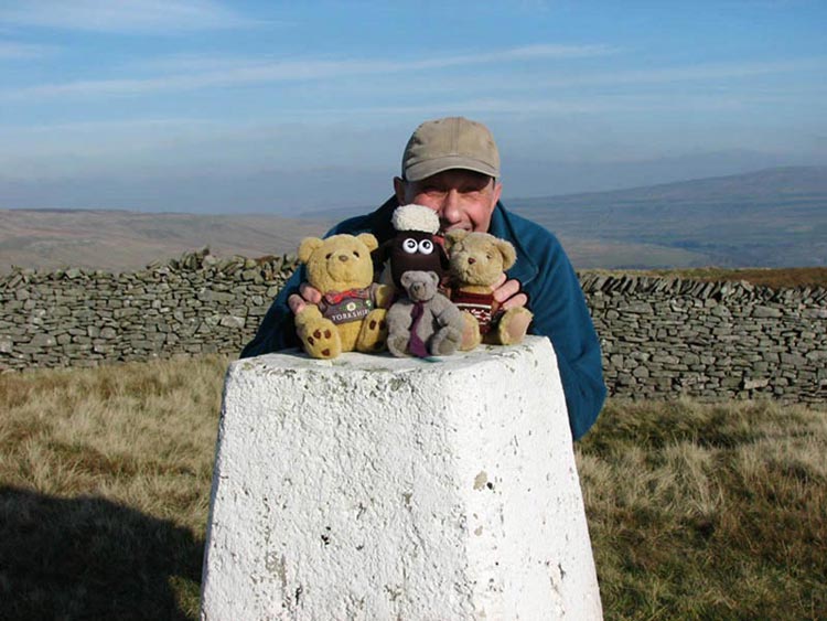
You can see the wall behind us.
This went on for miles and to reach out next objective - Horse
Head Moor, we had to follow this. It seemed that we would never
reach Horse Head, and indeed when the white trig point came into
view it was ages before we reached it. Looking back the High
Green Field it was very distant and we realised how far Uncle Bob
and Dad had had to walk! At Horse Head it was windy and Allen was
in danger of being blown off the trig point, so Uncle Bob kindly
held on to us while Dad took our photo.
We have no idea why it is called
Horse Head, as there were certainly no horses about and not even
any sheep either. Uncle Bob and Dad then worked out the names of
the hills they could see from the top, which were Darnbrook Fell,
Fountains Fell, Pen-y-Ghent, Plover Hill and Ingleborough. We are
very proud to be able to say that we have climbed them all too!
It was now the simple matter of walking along to a gate in the
wall and once through descending down to the valley and the car.
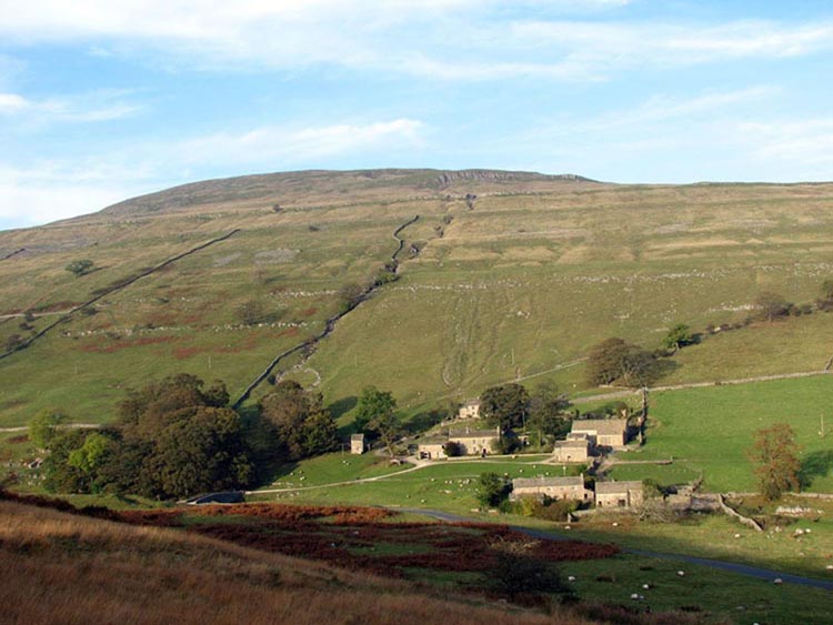
On the way we had a view of the hamlet of Yockenthwaite with the
hill Yockenthwaite moor behind. This is one to be climbed in the
future.
There are 100 tops in the Yorkshire
Dales and we had now done 45. We settled in the car now to have
our picnic - sandwiches and cake etc. Dad followed Uncle Bob to
the village of Buckden, where surprise surprise they went to a tea
room for tea and cakes!! Then we said our goodbyes to Uncle Bob
and we headed home. Dad stopped in Hawes to have a meal. He had
missed the excellent chip shop as it had closed about half an
hour before, so he went across the road and got burger and chips,
sitting on a seat by the road side to eat them. How common! Home
then at then end of another great day!